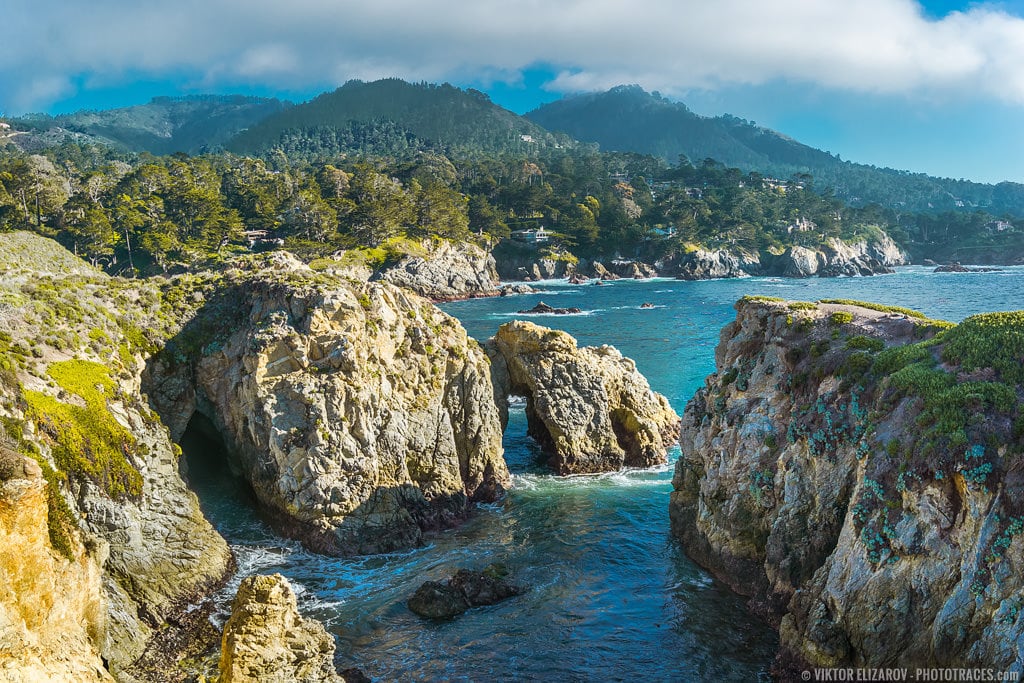
Point Lobos Natural State Reserve is a hidden gem nestled within Big Sur’s breathtaking cliffs and coastline and a haven for nature enthusiasts and explorers.
A popular destination known for its stunning scenery, hiking trails, and diverse wildlife, Point Lobos Natural State Reserve attracts hikers, photographers, and naturalists seeking to immerse themselves in its unique beauty.
Having visited Point Lobos State Reserve on numerous occasions, I can attest to its status as one of the most photogenic places for seascape and landscape photography. Join me on a journey as we unveil the wonders of Point Lobos Natural State Reserve, a true treasure within the captivating landscapes of Big Sur.
What is Point Lobos Natural State Reserve?
Point Lobos is a protected marine reserve, home to some of the best coastal scenery on the West Coast. The park has rocky cliffs, sandy beaches, cypress, and pine forests, making it a popular destination for hikers, photographers, birdwatchers, and scuba divers. It is one of California’s most frequently visited state parks.
Point Lobos is also called the “crown jewel” of the California state park system.
Point Lobos State Reserve was established in 1934 and encompassed about 5.36 square miles.
The name “Lobos” means “wolves,” given to the area by early Spanish explorers for a large population of sea lions bobbing at sea.

Where is Point Lobos State Reserve Located?
Point Lobos State Reserve is located in Northern California, Monterey County, only 3 miles (4km) south of Carmel By The Sea. It is the northernmost point of Big Sur’s coastal drive along Pacific Coast Highway. If you do Big Sur from north to south, you start the drive from Point Lobos.
Here is the official address of the Point Lobos:
Point Lobos
62 California 1
Carmel-By-The-Sea, CA 93923
How Far is Point Lobos from San Francisco?
It is 125 miles (200km) from San Francisco to Point Lobos; mostly highway driving, so you can make it in under 2h 30 min.
How Far is Point Lobos from Monterey?
It is only 7 miles (10km) from Monterey to Point Lobos. Monterey Peninsula is an excellent place to establish your headquarters when visiting Big Sur, Point Lobos, and Carmel.
How Far is Point Lobos from Los Angeles?
It is 300 miles (500km) from Los Angeles to Point Lobos. It is a beautiful drive which makes a fantastic road trip. I did it twice, and I would not mind doing it again.
Usually, I do it in 2 legs. First, I drive from Los Angeles to Morro Bay and spend a night there. The next day, I drive to Monterey and spend a couple of nights exploring the surrounding areas. And I always dedicate an entire day to Point Lobos.

What is the Best Time to Visit Point Lobos?
The best time to visit Point Lobos is just during any time of year. Point Lobos has very mild temperatures throughout the year. It is not too hot in summer and not too cold in winter. I recommend that you take advantage of the seasonal weather and see when it’s the warmest and least windy.
Also, the state park is within driving distance from densely populated areas such as San Francisco, San Jose, and Silicon Valley. It is common practice for residents of the urban areas to organize day-long driving trips to Point Lobos. As a result, it can be very crowded on good weather weekend days in Point Lobos.
If you want to escape the crowd and spend time exploring Point Lobos in relative solitude, I recommend avoiding weekends and holidays such as Memorial Weekend.
My favorite time to visit the park is during winter when it is chilly and windy. It guarantees that I will have the park to myself without anybody blocking my shots.
Weather in Point Lobos
The weather in Point Lobos is similar to the coastal areas of Northern California.
The summers are mild, with the highest temperature around 20-22C during the day. The warmest months are September and October.
The winters are warm, with the lowest temperatures around 14-15C during the day. The coldest winter months are January and February.
Point Lobos Opening Hours
Point Lobos State Park opens at 8 am. The official closing time is 5 pm, with the last visitor entry at 4:30 pm.

How Much Is Point Lobos Entry Fees?
There are no entry fees in Point Lobos State Park. You only pay for parking ($10) if you decide to drive into the park.
Can you walk into Point Lobos?
You can access Point Lobos State Reserve on foot. You park your car on the side of Highway 1 and then walk in from there. You will have to walk for a mile to reach the park’s main area from the entrance.
Parking in Point Lobos
Parking fees are $10 per car.
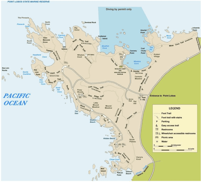
If you check the official Point Lobos map, you can find 8 or so parking areas. Plus, you can park on the side of the roads in certain places inside the park. But it is misleading. If I had to guesstimate, I would say that there are less than 80 parking spots in the entire park.
It means that if you are planning to visit the park on the weekend, by 9 am the parking lots will be full and you won’t be able to enter the park by car.
But as mentioned earlier, you can still park on the side of Highway 1 and walk into the park.
Best Point Lobos Hikes
Point Lobos has in total 16 official trails. They offer various scenery from open coastal areas, coastal cypress forest trails, and inland pine woods.
The beauty of the Point Lobos hikes is that you do not have to commit to any of them. You can mix and much, starting on one trail, transitioning to another, and finishing on an entirely different one.
But if you are a first-time visitor, it can be challenging to select the best hiking trails to better explore Point Lobos.
1. Point Lobos Loop Trail
- Distance: 10.8km (6.7miles)
- Elevation Gain: 225m (740ft)
- Type: Loop
- Difficulty: Easy to moderate
- Trailhead: You can start it anywhere in the park
If you check the official Point Lobos hiking trail map, you will not locate the Loop Trail. Because the Loop Trail is a combination of 9-10 shorter trails that allows you to explore all the areas of the state reserve in one visit.
If you visit Point Lobos for the first time and have at least 4-5 hours to spend, the Point Lobos Loop Trail is your best option. After completing the Loop Trail, you will be familiar with the entire park, and when you visit Point Lobos the next time, you will know exactly which part of the reserve you like the most. So you can dedicate the entire time you have to your favorite part.
It is precisely how I started. After completing the Loop Trail on my first visit, I realized that the Bird Island and Cypress Grove trails are the most exciting areas from a landscape photography perspective.


How Long Is the Point Lobos Loop Trail Hike?
The Point Lobos Loop Trail is 10.8km (6.7miles) long. But the beauty of it is that if you are short on time or expect weather change, you can always shorten the hike.
Where Does Point Lobos Loop Trail Start?
The Loop Trail can be started anywhere within the park where parking is available.
Once you have parked, you won’t have difficulty finding the trail since it runs throughout the park.
I prefer starting the Point Lobos Loop Trail at the tiny parking lot near the Tide Pools on South Shore Trail. But like I mentioned earlier, you can begin the Loop Trail from any location in the park.
2. Bird Island Trail and China Cove
- Distance: 1.3km (0.9miles)
- Elevation Gain: 23m (74ft)
- Type: Loop
- Difficulty: Easy
- Trailhead: Bird Island parking and picknic area
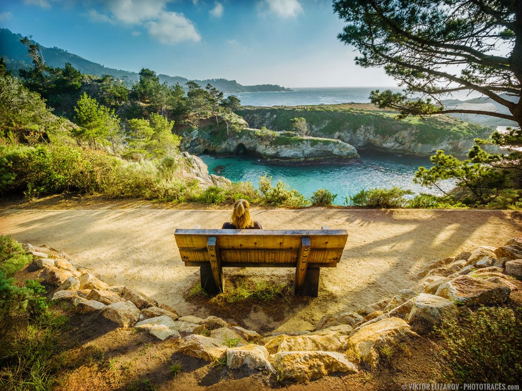
I consider the Bird Island Trail the most picturesque trail in the park. It is by far the most rewarding hike for photographers of any level.
The hike to Bird Island is an easy, family-friendly outing that offers incredible coastal views.
The Bird Island Trail can be accessed from the park’s southern end. It begins at the Bird Island parking and picnic area, just 0.9 miles from the park’s main parking and 1.7 miles from the entrance.
The main attractions of the Bird Island Trail are China Cove, Bird Island, and Gibson Beach.

China Cove in Point Lobos
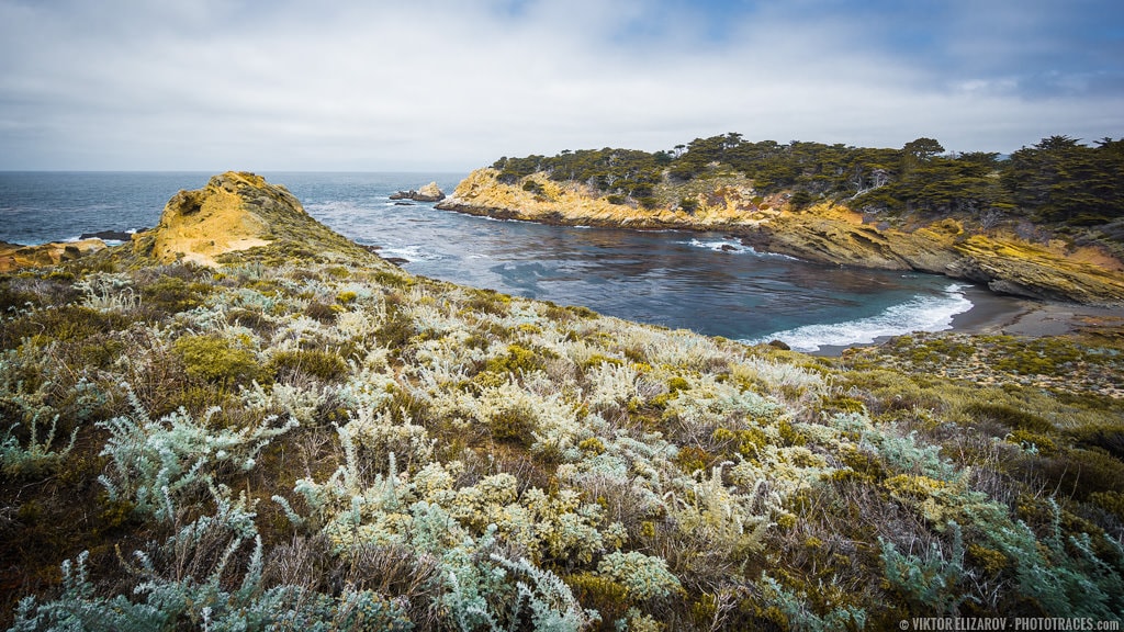
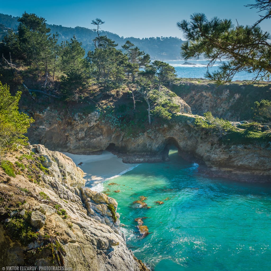
China Cove is a charming cove with a narrow beach surrounded by tall rock walls.
If you climb down to the beach, you will find tide pools with starfish and other ocean creatures in them.
Sometimes the access to the beach is closed for preservation and restoration purposes, but it won’t spoil your experience because the incredible views from the trail are spectacular.
During low tide, you can spot a small arch on the south side of the cove.

3. Cypress Grove Trail in Point Lobos
- Distance: 1.2km (0.8miles)
- Elevation Gain: 20m (70ft)
- Type: Loop
- Difficulty: Easy
- Trailhead: Sea Lion parking area
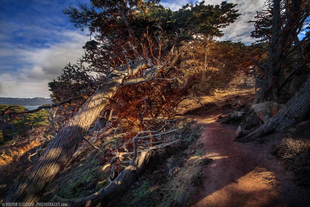
Cypress Grove Trail is my second most favorite hike in Point Lobos reserve.
The beginning of the 0.8 mile trail is outlined by cliffs with dramatic and spectacular ocean views where you can find plenty of photo opportunities.
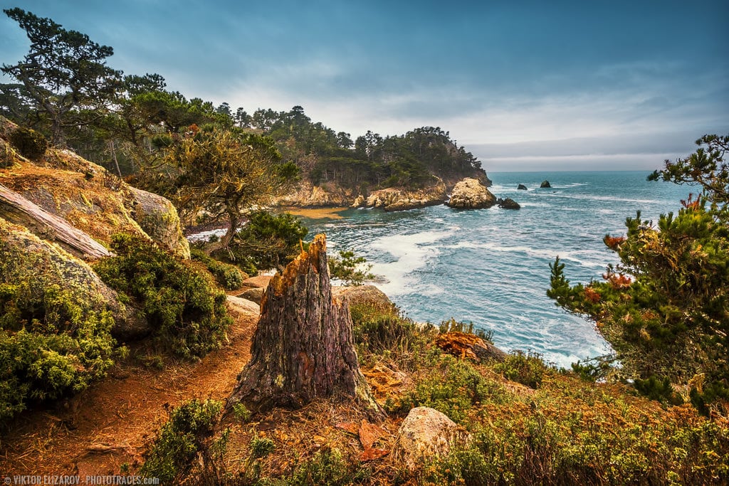
The trail leads through the coastal cypress forest and offers sweeping views of the cliffs and coastline.
The hike begins at the Sea Lion Point parking area.


4. Sandhill and Sea Lion Point Trails
- Distance: 0.6km (0.2miles)
- Elevation Gain: 10m (33ft)
- Type: Loop
- Difficulty: Easy
- Trailhead: Sea Lion parking area
The Lion Point Trail and Sandhill trail hike is the shortest in Point Lobos. It begins near the Lion Point parking area and then goes around the south side of the Headlands to a prominent rocky outcrop.
The trail climbs the bluff and offers views of the sea and the shoreline. It is the most popular trail in Point Lobos and is often crowded. The main attraction of the Sea Lion Point Trail is the sea lions, harbor seals, sea otters, and their antics. You can spot hundreds of sea animals lounging on the rocks below the trail. With some luck and the help of binoculars, you can spot orcas and whales.
Also, it is the most popular and spectacular spot for observing sunsets in wintertime. It can get quite crowded on sunny winter days just before park closure.


5. South Shore Trail in Point Lobos
- Distance: 4km (2.5miles)
- Elevation Gain: 13m (45ft)
- Type: Out and back
- Difficulty: Easy
- Trailhead: Sea Lion parking area or Bird Island parking and picnic area
The South Shore Trail follows the coastline, starting at Sandhill trail not far from the Sea Lion Point parking area. It ends at the Bird Island trailhead.
The trail is completely open, not offering shelter from the sun or wind. It is especially great for the ocean and coastal views, as it hugs the coast throughout its course.
See also: Best National Park Scratch Off Maps
The trail’s main attraction is Weston Beach and Hidden Beach, the best tidepooling location in the park. You can spot plenty of sea creatures in the pools of seawater during low tide.
The trail offers multiple easy access points to the seashore throughout the entire length.


6. North Shore Trail
- Distance: 5km (2miles)
- Elevation Gain: 45m (120ft)
- Type: Out and back
- Difficulty: Easy to moderate
- Trailhead: Sea Lion parking area or Whaler’s Cove parking area
The North Shore Trail is probably the most challenging hike in reserve. But I would still rate it as easy to moderate.
The trail winds through the rocky pine forest with multiple vista points, offering striking views of Carmel Bay.
It is worth your time and effort.


Point Lobos Hiking Trail Map
Official Point Lobos Hiking Trail Map (PDF)
Download Point Lobos Hiking Trail Map (PDF)
Point Lobos Photography Tips
There are plenty of challenges when visiting Point Lobos as a photographer.
The main challenge here is you are pretty much out of luck with sunsets and sunrises.
Let me explain.
The reserve is located on a peninsula with the Pacific Ocean on the west, north, and south. Behind the park, on the east, resides a mountain range. The range shields the sun during the sunrise.
When Monterey Bay is enjoying the warm early morning sunlight, the Point Lobos is still in the dark shadows. And when the sun finally appears over the mountains, it is already too high. You can forget about the golden hour light.
And because the Point Lobos Reserve closes at 5 pm, you can only catch sunset light in winter when the days are short.
It means you have to be more creative without relying on sunrise and sunsets.
Another challenge is cloud cover in California. It is much poorer than on East Coast or in Canada. It is not uncommon to have an entire week with clear skies without clouds. You need to figure out how to deal with the harsh midday light.
Here is my tip on approaching different weather conditions in Point Lobos.
When it is sunny, and the sky is clear, I look for photo opportunities in the park areas with the forest.
My favorite hikes in sunny weather are Cypress Grove Trail and North Shore Trail. The cypress trees and pine trees defuse the harsh sunlight making it softer. And do not forget to visit Cannery Point and stop by the historic whaling cabin, built by Chinese fishermen almost two centuries ago. It is now Whalers Cabin Museum.


When it is cloudy or even stormy, I opt to hunt for exciting photos in open areas of the reserve. My favorite hikes are South Shore Trail and Bird Island Trail.


And the last tip. Bring UV or clear filters to protect your lenses. The saltwater mist is always in the air because of the strong winds along the California coast. Constantly wiping the front element of any lens can easily cause damage, especially when salt residue is present.
Point Lobos State Natural Reserve: FAQ
Are dogs allowed in Point Lobos?
Dogs are not allowed anywhere in Point Lobos. It is not even permitted to leave dogs in the cars in parking areas.
Are Bikes Allowed in Point Lobos?
All trails within the reserve are off-limits to bicycles, but bikes are permitted on the paved roads inside the park.
Which is the best trail in Point Lobos?
There are 16 official hiking trails in Point Lobos State Reserve, and I hiked along all of them. And from the perspective of landscape and seascape photography, I consider the Bird Island and Cypress Grove trails are the best and most spectacular hikes.

How many trails does Point Lobos have?
Point Lobos State Reserve has 16 official trails. But because the reserve is not large and you have main park attractions close to each other, you can design your own hikes combining the existing trails.
- Cypress Grove Trail
- Sea Lion Trail
- Sand Hill Trail
- South Shore Trail
- Bird Island Trail
- North Shore Trail
- Moss Cove Trail
- Camelo Meadow Trail
- Granite Point Trail
- Whalers Cabin Trail
- Whalers Knoll Trail
- South Plateau Trail
- Mount Meadow Trail
- Lace Lichen Trail
- Pine Ridge Trail
- Old Veteran Trail
Can you swim in Point Lobos?
Yes, you can swim in Point Lobos. The best place for swimming is Gibson Beach, located at the southmost end of the park.
But you have to remember that it is North California, and water never gets warmer than +15C, even during the summer.


What Is the Water Temperature in Point Lobos?
You have the same pattern as in the rest of Northern California with the water temperatures. The water is cold, and there is almost no seasonal change.
The highest water temperature in Point Lobos is in September, and it is only 59°F (15°C). The coldest water in March and April is about 54°F (12°C).
Are there Waterfalls in Point Lobos?
There are no waterfalls in Point Lobos State Reserve. The only waterfall in the entire Big Sur is the spectacular and popular McWay Falls, located in Julia Pfeiffer Burns State Park. It is only 34 miles (55km) from Point Lobos.
Do you need a reservation for Point Lobos?
Because of the increased popularity of the Point Lobos State Reserve, in 2018, there were plans to implement reservations for visiting the reserve. I believe the pandemia interrupted the project, and the reservation has not been implemented yet. But it can change in the future.
Is there cell service at Point Lobos?
Point Lobos State Reserve is close to urban areas (Carmel, Monterey) and, as a result, has no problem with the cell service.
Is there Camping in Point Lobos?
There is no camping in Point Lobos. It is a day-only park. If you are looking for a campground, you can find multiple options along Highway 1 in the Big Sur area. If you are looking for a motel, the Carmel and Monterey areas are your best options.
Is Scuba Diving Allowed in Point Lobos?
Point Lobos State Natural Reserve in California is a popular destination for scuba diving, but it has specific regulations in place to protect the marine environment. Diving is allowed, but it is strictly regulated, and a permit is required. Please check the regulation details at parks.ca.gov
Whalers Cove and Bluefish Cove are two popular locations open for scuba diving.
Point Lobos State Natural Reserve: Conclusion
I hope my guide to Point Lobos will help you to discover one of the most exciting and visually stunning places not only in California State but in the entire southwest.


